Veuillez patienter - l'impression de la page est en cours de préparation.
La boîte de dialogue d'impression s'ouvre dès que la page a été entièrement chargée.
Si l'aperçu avant impression est incomplet, veuillez le fermer et sélectionner "Imprimer à nouveau".
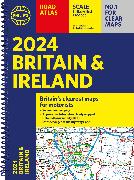
2024 Philip's Road Atlas Britain and Ireland

Spiral A4
Taille reliure2024 Philip's Road Atlas Britain and Ireland
ISBN/GTIN
CHF30.90
2.6 % TVA incluse

Produit

RésuméPhilip's is No. 1 in the UK for clear mapping and the Philip's 2024 Road Atlas Britain and Ireland is the top of the range, A4-sized, paperback atlas featuring fully updated maps from the Philip's digital database. The maps are super-clear and have been voted Britain's clearest and most detailed in an independent consumer survey.
Details
ISBN/GTIN978-1-84907-624-1
ProduktartBuch
EinbandartSpiralbindung
FormatKamm-Spiralbindung
ProduktionslandVereinigtes Königreich
Erscheinungsjahr2023
Erscheinungsdatum01.06.2023
Seiten256 Seiten
SpracheEnglisch
MasseLargeur 222 mm, Hauteur 298 mm, Épaisseur 10 mm
Gewicht700 g
BZ-Nr.43856811

Auteur

Philip's has been at the forefront of creating maps and atlases since 1834. Whether a local street map or a fact-packed World Atlas, we use the most up-to-date technology, expertise and our global network to ensure our customers have all the information they need.
Verwendung von Cookies
Cookies helfen uns, das Benutzererlebnis zu verbessern. In den Einstellungen können einzelne Cookie-Arten ausgewählt werden. Weitere Informationen finden sich hier:
Datenschutzvereinbarung
Alle Cookies akzeptierenEinstellungen