Bitte warten - die Druckansicht der Seite wird vorbereitet.
Der Druckdialog öffnet sich, sobald die Seite vollständig geladen wurde.
Sollte die Druckvorschau unvollständig sein, bitte schliessen und "Erneut drucken" wählen.
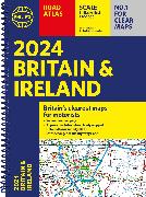
2024 Philip's Road Atlas Britain and Ireland

Spiral A4
Einband gross2024 Philip's Road Atlas Britain and Ireland
ISBN/GTIN
CHF30.90
2.6 % TVA incluse

Produit

RésuméPhilip's is No. 1 in the UK for clear mapping and the Philip's 2024 Road Atlas Britain and Ireland is the top of the range, A4-sized, paperback atlas featuring fully updated maps from the Philip's digital database. The maps are super-clear and have been voted Britain's clearest and most detailed in an independent consumer survey.
Details
ISBN/GTIN978-1-84907-624-1
ProduktartBuch
EinbandartSpiralbindung
FormatKamm-Spiralbindung
ProduktionslandVereinigtes Königreich
Erscheinungsjahr2023
Erscheinungsdatum01.06.2023
Seiten256 Seiten
SpracheEnglisch
MasseLargeur 222 mm, Hauteur 298 mm, Épaisseur 10 mm
Gewicht700 g
BZ-Nr.43856811

Autor

Philip's has been at the forefront of creating maps and atlases since 1834. Whether a local street map or a fact-packed World Atlas, we use the most up-to-date technology, expertise and our global network to ensure our customers have all the information they need.
Ce site utilise des cookies
Les cookies nous permettent d'améliorer les conditions d'utilisation. Vous touverez des informations supplémentaires ici:
protéction des données